[Originally published as Carnarvon Creek flows through a water gap carved during Noah’s Flood]
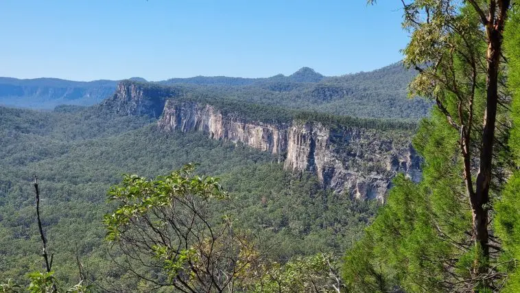
As you travel the unsealed road to Carnarvon Gorge, just before you reach the Camping Area, you pass through a break in Clematis Ridge. The photo from the top of the ridge shows it running south from where the people are sitting. Clematis Ridge extends across the whole entrance to the Gorge for a distance of some 10 kilometres.
Behind Clematis Ridge the white cliffs of Precipice Sandstone can be seen. These form the inner part of Carnarvon Gorge, the entrance of which lies beyond the edge of the photo to the right. In the distance behind the white cliffs we can see the flat plateau atop the south rim of the outer Carnarvon Gorge. This is an erosional remnant of a thick basalt lava field, known as the Buckland Volcanic Province. This basalt once capped the whole area but is now, along with the landscape, mostly eroded away.

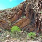
Clematis Ridge is the western limb of an anticline, an inverted U-shaped fold in the sedimentary rocks. It’s part of the Bowen Basin (see geological cross section). The strata in the ridge are called the Clematis Group and they dip at about 25 degrees to the west. Notice that the ridge has been cut in several places. The road into Carnarvon Gorge flows through one of the gaps—a water gap through which Carnarvon Creek also flows.
These gaps that cut across the ridge are evidence that, in the past, there was a much greater depth of water that drained from the gorge. The water level was higher than Clematis Ridge as it flowed out of the Gorge to the east. Think of how floodwaters can breach an earth dam today. Once the dam has been overtopped, the waters will continue to flow through the breach, eroding it deeper as the water level drops. This illustrates how the water gaps could have formed through Clematis Ridge, cutting across the geological structure of the area.
These water gaps in the Clematis Ridge, especially the one used by Carnarvon Creek, are tell-tale evidence left by the receding waters of Noah’s Flood. They were cut quite late in that event.

Loved this article. Wish there were more pictures. The one featured reminds me so much of the area where I grew to manhood in Utah, USA on the banks of the Colorado River. The things I saw growing up were so beautiful and inspirational. It could have been more so if I had a Christian perspective at the time. Instead I viewed what I saw as beautiful works of natural processes (accidental beauty). Now I realize what a privilege I experienced of seeing the ongoing works of God’s hands. Thanks for the reminder…the heavens and the earth declare the glory of God.