[Originally published as Phillip Island Excursion Site 4: Kitty Miller Beach and Watt Point]
 At the southern end of Kitty Miller Road, there is parking at Kitty Miller Bay from where you can visit three points of interest. The first is Kennon Head, the second is Kitty Miller Beach itself and the rocky outcrops to the east. Go down the steps to the beach and east over the beach to the first few rocky outcrops towards the headland called Watt Point (about 1 kilometre return). Be careful on the rocks.
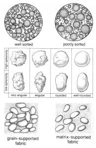
Pause to examine the sand on the beach. Check the grains, size, roundness, composition. Here the sediment is loose.
What would need to happen for the sediment to become hardened sandstone?
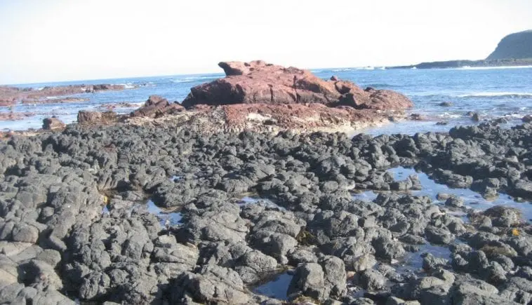
Now turn to the black basalt outcrops on the rocky headlands to the east (and west) of the beach. This basalt hardened from a flow of volcanic lava. Imagine what it was like when it was still glowing red hot and flowing over the land. Note the appearance of the basalt rock. Check the colour and jointing.
Can you see any layers that represent one lava flow? How thick are the layers? Check for holes (vesicles) in the basalt. Are there any minerals in the holes? Are there any mineral deposits in the joints? Note from your geological map that these rocks are called the Older Volcanics.
You will notice the beach to the east and near the sandy bluff is strewn with rounded cobble-sized rocks.
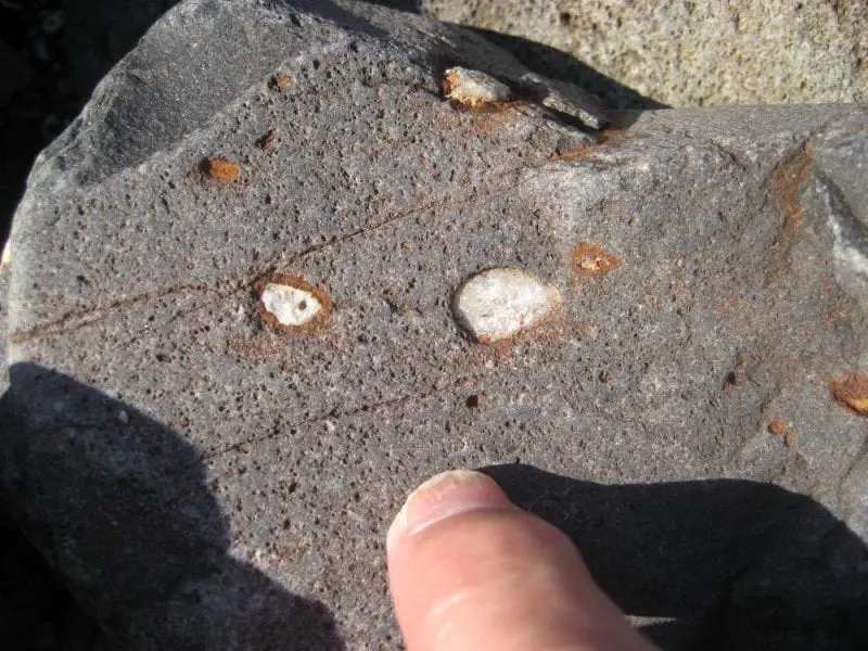
Check the composition of the cobbles. Where do you think they have come from? Agates and zeolites are often found in the cavities, or vesicles, of the cobbles, gravels, and rock outcrops here. Good specimens are popular with mineral collectors. See if you can find some.
Can you see where the sandy/cobbly beach end and the black basalt headland begins. Which was deposited first, the sand or the basalt? How do you know?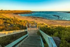
Now for the steep beach embankments around the rocky headland. Pay attention to how the basalt in these embankments has been weathered and is crumbly. The soft material in the embankments still shows signs of vertical columns in places—the remnant of an original columnar basalt deposit.
See if you can spot a second sort of rock in the headland—one that is red to orange, indicating it is iron-rich. Does it lie under or over the black basalt flow?
If you can get a good look without putting yourself in danger, up close you can observe how this layer is up to 1 metre thick and composed of rounded cobbles in a fine matrix. It looks like a sedimentary rock and is interpreted as a volcanoclastic deposit, i.e. a deposit where the volcanic material has been ripped up and reworked by water. Specifically, it is described as agglomerate which is a coarse accumulation of large blocks of volcanic material that contain at least 75% rounded volcanic bombs—ejected lava that assumes a round shape.
But it’s often subjective to say that these rounded rocks were bombs and not just water-rounded stones. This red layer forms part of the Older Volcanics.
Significance
These deposits show that the basalt lava was erupting over the landscape while there was much flowing water and sedimentation—a situation that is consistent with the Flood. You can also see something of the way the basalt was altered after it was deposited, producing soft bleached soil in the bluffs.
This guide is available as a booklet, the geological excursion guide for Phillip Island. The complete guide is available as a booklet on creation.com Aussie store.

