[Originally published as Carnarvon Gorge rises above the waters of Noah’s Flood]
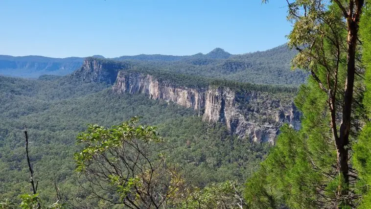
The standard explanation for Carnarvon Gorge in Central Queensland, Australia, is that Carnarvon Creek, which flows through the gorge, shaped it over millions of years.
However, there are many features about the Gorge that contradict this story, but are explained by the receding waters of Noah’s Flood.

In order to appreciate these we need to consider what happened to this area during the Flood. We also need to ignore the millions of years, or at least not take them literally, because those numbers are philosophy driven (see How dating methods work).
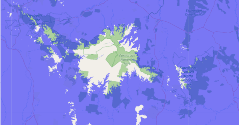
A useful tool for picturing these receding floodwaters is a web application, originally designed to study sea level rise [Editor’s note: the original version is defunct, this version works in 2026, but includes ads]. It colours Google maps according to a chosen land elevation. On the above map, the blue area shows the land that would be inundated by a sea-level rise of 600 m. As you can see, very little of Queensland, or Australia, sits above the 600 m level. Carnarvon Gorge can be seen as a small tongue that sits immediately south of the Consuelo Tableland, and runs to the south-east.
According to the detailed account in the Bible, the floodwaters began to recede some 150 days after the Flood started (compare Genesis 8:4 and 7:11), at which time the Ark came to rest on the mountains of Ararat in the Middle East. Today these mountains could be at an elevation of some 4000 m to 5000 m depending on the exact location where the Ark landed. The Bible tells us that, after the Ark grounded, the waters receded for a further 74 days (compare Genesis 8:5 with 8:4) before the tops of the other mountains in the area became visible to Noah and his family. This was 224 days (150 + 74) after the start of the Flood. Presumably these mountains would have been around 4,000 m in elevation.
This means that it would have been at least 224 days after the beginning of the Flood before the Consuelo Tableland emerged above the receding floodwaters. This tableland would have been one of the first areas of Queensland to emerge. The receding floodwaters would have played a significant part in the carving of Carnarvon Gorge.
This simple analysis has given us a broad framework to understand the timing of the carving of Carnarvon Gorge, and think about the possible processes that were involved.