[Originally published as Ormiston Gorge, Central Australia]
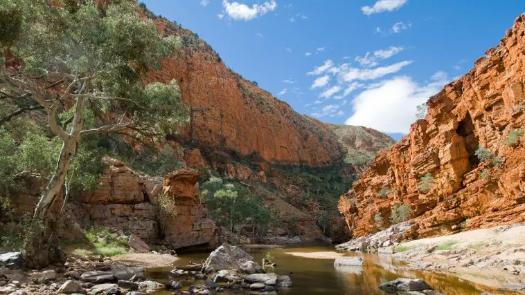
The spectacular geology and landforms of the MacDonnell Ranges in Central Australia are graphically revealed in Ormiston Gorge, which cuts some 300 metres deep through a high ridge, around 135 km west of Alice Springs.
The gorge exposes thick strata that were deposited very early in Noah’s Flood during the initial high-energy period as the waters started to burst across the earth. The thick beds are part of the Heavitree Quartzite, which is widespread through Central Australia. The strata, stacked like vast pancake sheets, indicate that the sediment was laid down by high-energy flows of water that covered a large area.1
Within the evolutionary timescale, the rocks are assigned to the Neoproterozoic some 800 to 760 million years ago, but the catastrophic nature of Noah’s Flood washes those ideas of long ages away.
Later during the Flood, as the waters continued to rise during this geological upheaval, enormous forces in the earth’s crust slid the rocks across the earth, bending and cracking them.

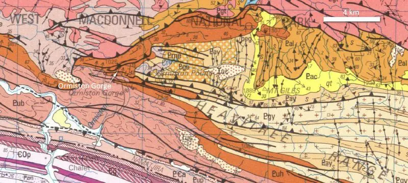
Two layers of quartzite are visible in the cliff. The top layer was thrust some 2 km from the north to its current location, and sits on another slab of quartzite, forming what is known as a thrust zone.
Some months later, after the waters of the Flood had come upon the earth and peaked over what would become the continent of Australia, more tectonic upheavals began to unfold. The ocean basins began to sink causing the water to start draining from the continent. The landforms around Central Australia were carved by the enormous forces of the retreating floodwaters.
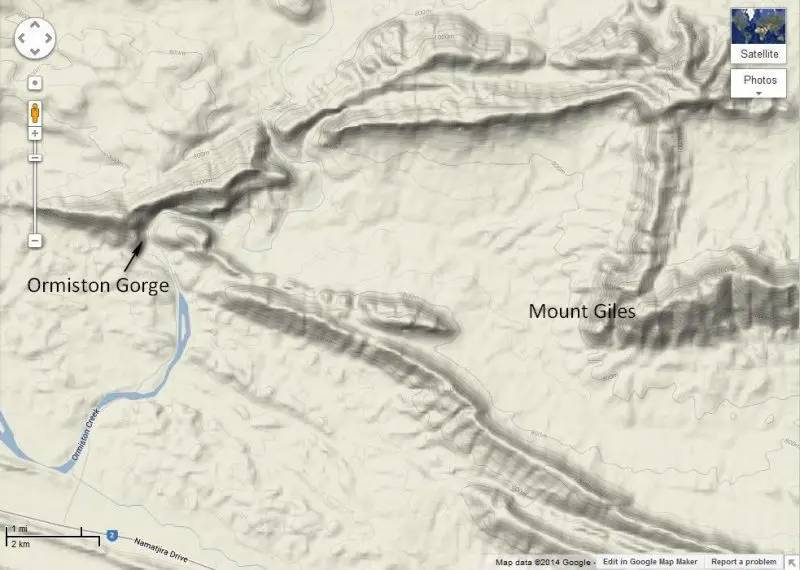
The creek enters Ormiston Gorge flowing west and changes direction in the gorge to flow south. Downstream of the gorge the creek flows through the rocky ridges that run in an east-west direction. These deep gashes across the rock ridges are called water gaps, narrow gorges that the creeks now run through. There are many water gaps in Central Australia, some of which are clearly visible in the Google Earth image above.

These water gaps were formed by the retreating floodwaters. In the middle of the Flood when the water was deep over the land and began to retreat, it flowed over the ranges, shaving some parts of them a little lower. As the water level dropped, the high parts of the ridges emerged, and the receding water was constrained to flow through low parts, cutting a gap. As the water continued to drain through the gap, it cut the gorge deeper and deeper.
The orange and red quartzite rock in Ormiston Gorge is cut by fractures, allowing large, hard boulders to break free from the wall and fall onto the floor below. Although many boulders are lying around, there are not many of them compared with the size of the gorge. This indicates that the gorge walls are relatively young, and that erosion has not been going on for millions of years. Otherwise the gorge would be full of boulders.
Reference
- Lindsay, J.F., Heavitree Quartzite, a Neoproterozoic (ca800–760 Ma), high-energy, tidally influenced, ramp association, Amadeus Basin, central Australia, Australian Journal of Earth Sciences 46:127–139, 1999.


