[Originally published as Giant kauri tree unearthed in New Zealand was ripped up and buried by Noah’s Flood]
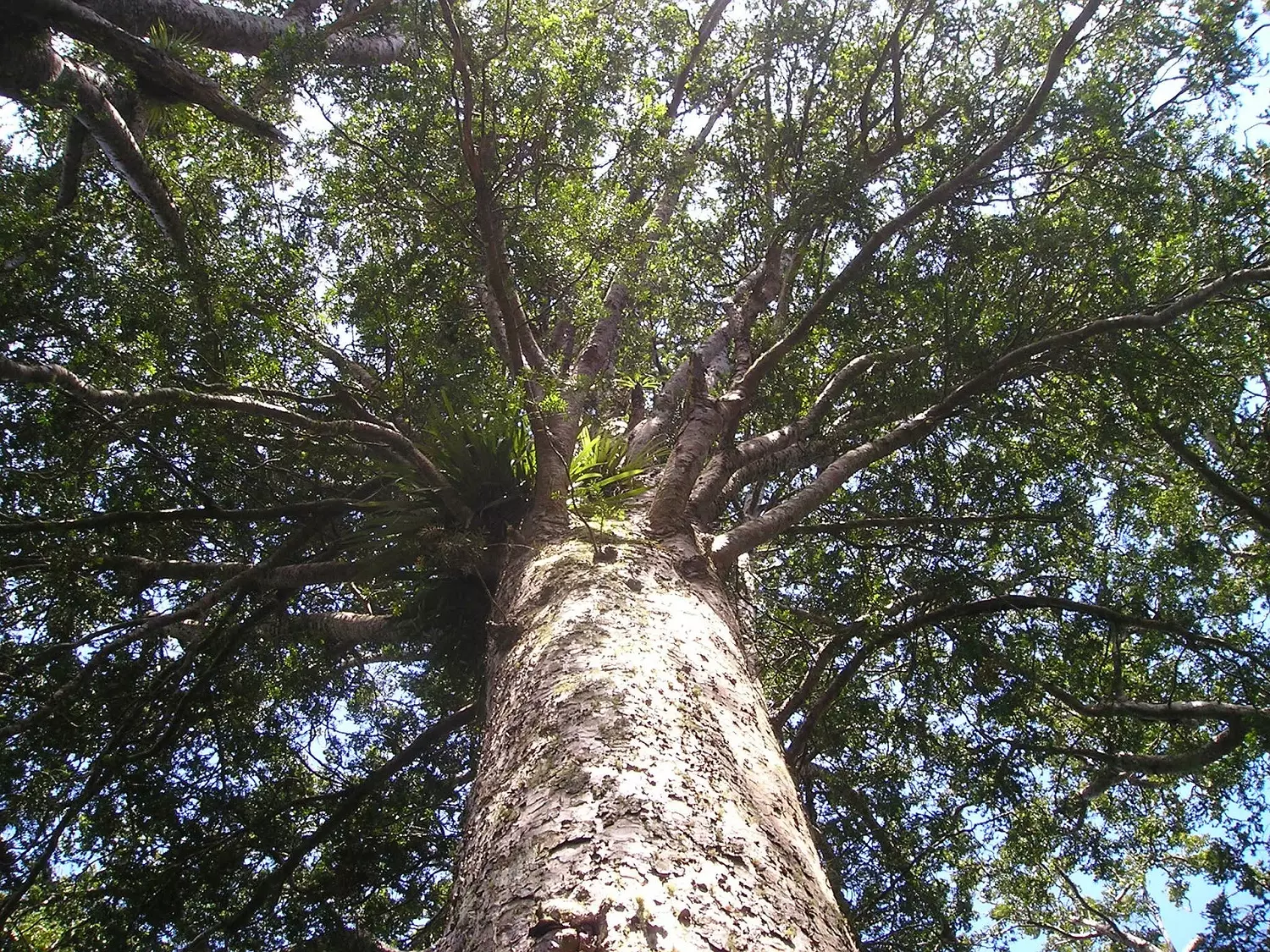
News reports in March 2019 featured an enormous kauri tree (Agathis australis) unearthed at New Zealand’s Ngawha geothermal power station site some 180 km north-north west of Auckland (just 5 km east of Kaikohe).1
In February 2019, it was found 8 m deep in clay as contractors were doing earthworks for a power station expansion. It was 20 metres [65.6 ft] long, 2.5 m [8.2 ft] in diameter, and estimated to weigh 60 tonnes [66.4 US tons].2 The power company, Top Energy, began earthworks in 2017 and had evidently excavated 900,000 cubic metres of soil before finding the tree. It is the only tree that has been found.

An article by Newsweek reports comments from Alan Hogg, director of the radiocarbon dating laboratory connected with New Zealand’s University of Waikato. The article says that carbon dating revealed the kauri tree lived for 1,500 years, between 41,000 and 42,500 years ago.3 Alan Hogg is recognised as an international authority on radiocarbon tree-ring dating, including development of the Southern Hemisphere C-14 calibration curve.4
Here are some comments on this news report as I think about it from a biblical geological perspective.
Carbon dates ranging from 41,000 to 42,000 years are typical
of dates for samples of wood that grew in the pre-Flood era and were ripped up during Noah’s Flood. (See Radioactive ‘dating’ in conflict! Fossil wood in ‘ancient’ lava flow yields radiocarbon.) This is because the C-14 concentration in the pre-Flood era was much less than it is today. (See figure 3 of The Creation Answers Book chapter 4 which illustrates how C-14 changed from pre- to post-Flood.)
With such ‘old’ C-14 dates it seems unlikely that the kauri tree would have grown in the post-Flood era
The Flood ended about 4,500 years ago. If the tree grew for 1,500 years, then it would have been ripped up and buried about 3,000 years ago (around 1000 BC). Any growth in the period from 3,500 to 3,000 years ago would give a C-14 result between 4,500 and 3,500 C-14 years. (See figure 3 in A preliminary age calibration for C-14 in the post-glacial maximum period.) Hence, the C-14 ‘dates’ seem to indicate the tree is from the pre-Flood era.
Interestingly, the estimated age of the tree, 1,500 years,
is about the same as the duration of the pre-Flood era, 1,700 years. The age may have been estimated by counting rings, or from the tree diameter. Or it may have been estimated by C-14 dating of samples from the middle and outside of the tree. In that case, it’s possible that the age of the tree may be overestimated, if there was a build-up of C-14 in the pre-Flood era.
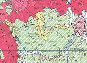
I checked the geological map (Whangerai 1:250,000)5 for clues
whether the tree was buried in Flood or post-Flood deposits. The area is dominated by the Whangai Formation, which is classified as late Cretaceous, 65 million years in the long-age scheme. Kauri trees are not reported in these sediments. There is an area labelled as Quaternary (eQa) and dated on the geological map at 128,000 years to 1.8 million years, in the area where the power plant is located. It is described as moderately consolidated mud, sand, gravel and peat. The tree was buried 8 m deep in clay, so I expect the kauri log was buried in this deposit.
There is a discrepancy between
the 0.128 to 1.8 million years of the sediment and the 41,000 years for the kauri tree. Either the C-14 date will need to be discounted or the Quaternary deposit assigned a different date.

Pre-Flood trees would mean
they were buried late in the Flood, similar to the brown coal deposits in Victoria, such as at Yallourn. This means that the forests now in New Zealand are related to the trees that were buried. They began to grow after the Flood from the vegetation that was deposited on the land by the Flood as the floodwaters went down.
Conclusion
Here are my preliminary conclusions about the kauri tree unearthed early 2019:
- The huge kauri tree grew in a kauri forest before the Flood.
- The Flood catastrophe ripped up the trees, separating the logs from the branches and leaves, so that the tree had no roots or branches.
- The logs accumulated in log-mats which floated around on the oceans during the Flood.
- As the waters of the Flood receded, and the energy of the receding water flow decreased, the log mats deposited in the smaller river valleys, and they were rapidly covered with sediment.
- There is a discrepancy in the C-14 age of the tree and the age assigned to the Quaternary deposit on the geological map. Either the C-14 date will need to be discounted or the Quaternary deposit assigned a different date.
- Once the floodwaters had receded, the kauri vegetation left on the surface provided the seeds and cuttings that enabled the post-Flood forests to grow and become established in New Zealand.
References and Notes
1. Lois Williams, Giant kauri unearthed from nine metres underground, 20 March 2019; https://www.rnz.co.nz/news/national/385200/giant-kauri-unearthed-from-nine-metres-underground
2. The dimensions vary between reports.
3. Hannah Osborne, Ancient tree with record of earth’s magnetic field reversal in its rings discovered, 7 April 2019; https://www.newsweek.com/ancient-tree-discovered-earths-magnetic-field-1447570
4. The purpose of the Southern Hemisphere C-14 calibration curve is to convert Southern Hemisphere C-14 determinations into a calendar year date. The fact that C-14 must be calibrated against tree rings means that C-14 is not an absolute dating method. And, it seems that the calibration is different between the southern and northern hemispheres.
To construct a calibration from tree rings requires a long, continuous tree-ring record to be assembled from multiple shorter tree-ring sections. Note that this kauri log only spans 1500 years, so many logs would be required to cover the long-age uniformitarian timespan. To connect these sections involves multiple assumptions, all based on the uniformitarian philosophy of long ages. Especially significant is the fact that the calibration ignores the effects of Noah’s Flood on how carbon-14 ratios changed over Earth’s history.
5. 1:250 000 Geological Map of New Zealand (QMAP); https://www.gns.cri.nz/Home/Our-Science/Land-and-Marine-Geoscience/Regional-Geology/Geological-Maps/1-250-000-Geological-Map-of-New-Zealand-QMAP