[Originally published as Google earth reveals ancient flow channels through mountains on Cape Peninsula south of Cape Town, South Africa]
Here are some Google-Earth images of the Cape Town area, prompted by reading an article on Yahoo! News entitled African Mountain Range Could be World’s Strongest.
The researchers calculated erosion rates for the mountains based on measuring radioactive isotopes of beryllium. They calculated an unbelievably slow rate of erosion for the Table Mountain area, but did not question their result, which they acknowledge was orders of magnitude less than they expected. Instead they developed a story that attributed the slow erosion to the quartzite composition of the mountain.

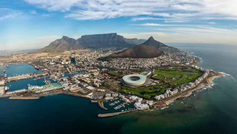
The small amount of erosion of the mountains around Cape Town is quite obvious by looking at the steepness of the escarpments and the absence of erosional debris at their base. Such slow erosion may be a surprise to long-age uniformitarian geologists, but the features of the mountain are what would be expected within the biblical geology paradigm.
The area around Table Mountain preserves many channels cut deeply into the mountains, features called wind gaps. These are characteristic of the sort of erosion that occurred during the retreating stage of Noah’s Flood, particularly the dispersive phase (see biblical geology classification criteria and geological environments).
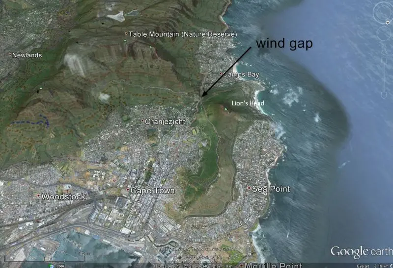
The first image shows a wind gap in the valley wall surrounding Cape Town. It runs in the direction of the arrow to the southwest.
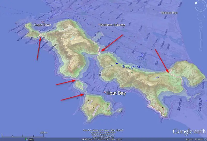
The second image shows quite a few wind gaps through the range that runs south of Cape Town along the peninsula. These gaps are revealed using Google Earth by setting the sea levels of the area at 200 and 120m asl.
Wind gaps pose a quandary for the conventional long-age paradigm, because with erosion rates supposedly so low, how could the wind gaps have formed? For any kind of channel erosion, the shear stress of the stream has to be larger than the critical shear stress of the stream bed. So in this case, the shear stress of the streams that carved such deep gaps in resistant strata must have been very large indeed.
That conclusion matches the idea of large water flows. In other words, the wind and water gaps are what we would expect from the receding waters of Noah’s Flood.