There are many great pieces of evidence for creation and/or the flood: Dinosaur soft tissue1, the complexity of life2, the limited capability of mutation3, the geology of the Mount Saint Helen’s eruption and the Spirit Lake log mat4 and that’s just hitting some of the high points…
However, much of this evidence requires either travel, specialized equipment, or expensive materials to experience in person. Genesis Science Network and other video content providers go a long way towards bridging this gap.
But, there is something very special about actually seeing the evidence in person. The good news is that evidence for the flood can be seen in millions of places all over the world. Probably near you!

Let’s have a look:
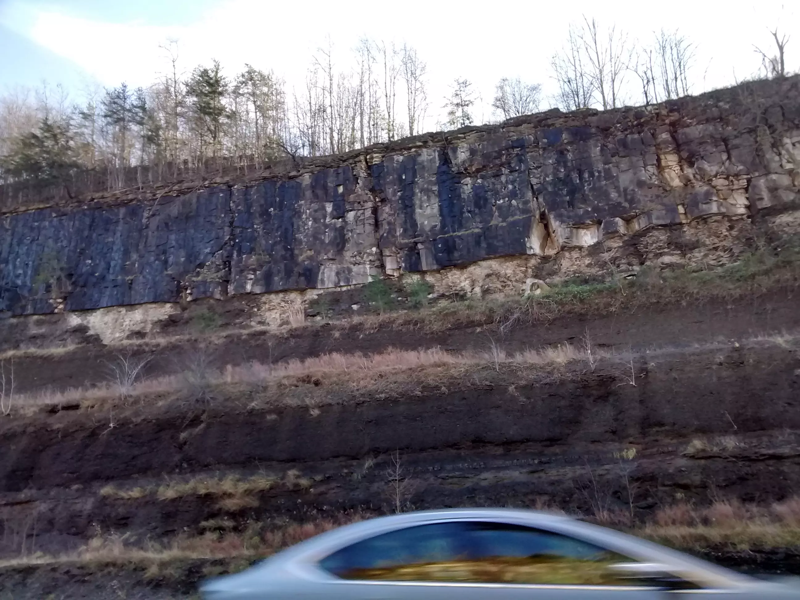
If you live in an area that is covered by sedimentary rocks (these are non-volcanic rocks formed when mud, sand, pebbles, etc, harden into rock) you may see road cuts like the one above. Millions of people zip every day through road cuts like the one above without a second glance. Yet many provide evidence of a global, world wide flood.
Let’s look at the road cut from Kentucky above
Two facts we can easily observe:
- The layers of rock are clearly different from each other.
- The boundaries between the layers are sharply defined.
Sometimes roads will allow you to follow the same layer for miles as various cuts reveal the same rock layers over and over. Which brings us to our next fact:
3. Layers often stretch over vast areas.
In particular, layers buried early in the flood tend to be extremely large9, 10.

Here are some more examples:
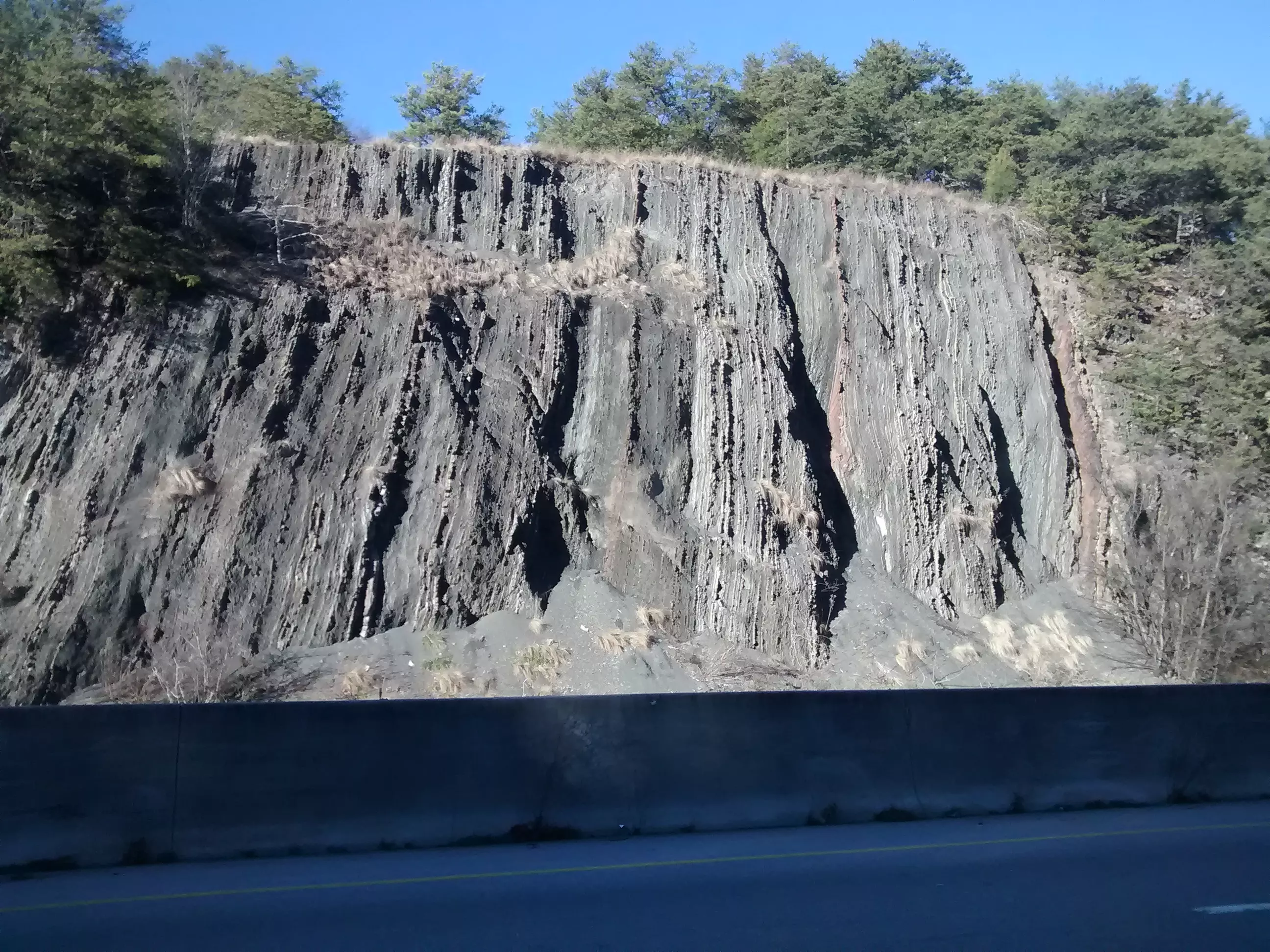
This is a road cut along the I-75 freeway near Cleveland, Tennessee. The concrete barrier at the bottom of the photo divides north and south bound traffic. When the rock layers were formed they were essentially flat, but pressure from the creation of the nearby Appalachian mountains buckled this slab of material nearly vertical. Even after being tilted almost 90 degrees we can see the layers clearly with their sharply defined boundaries.
Above is a diagonal set of layers from the same road cut. Yet even after being shoved into this position the layering is still distinct.

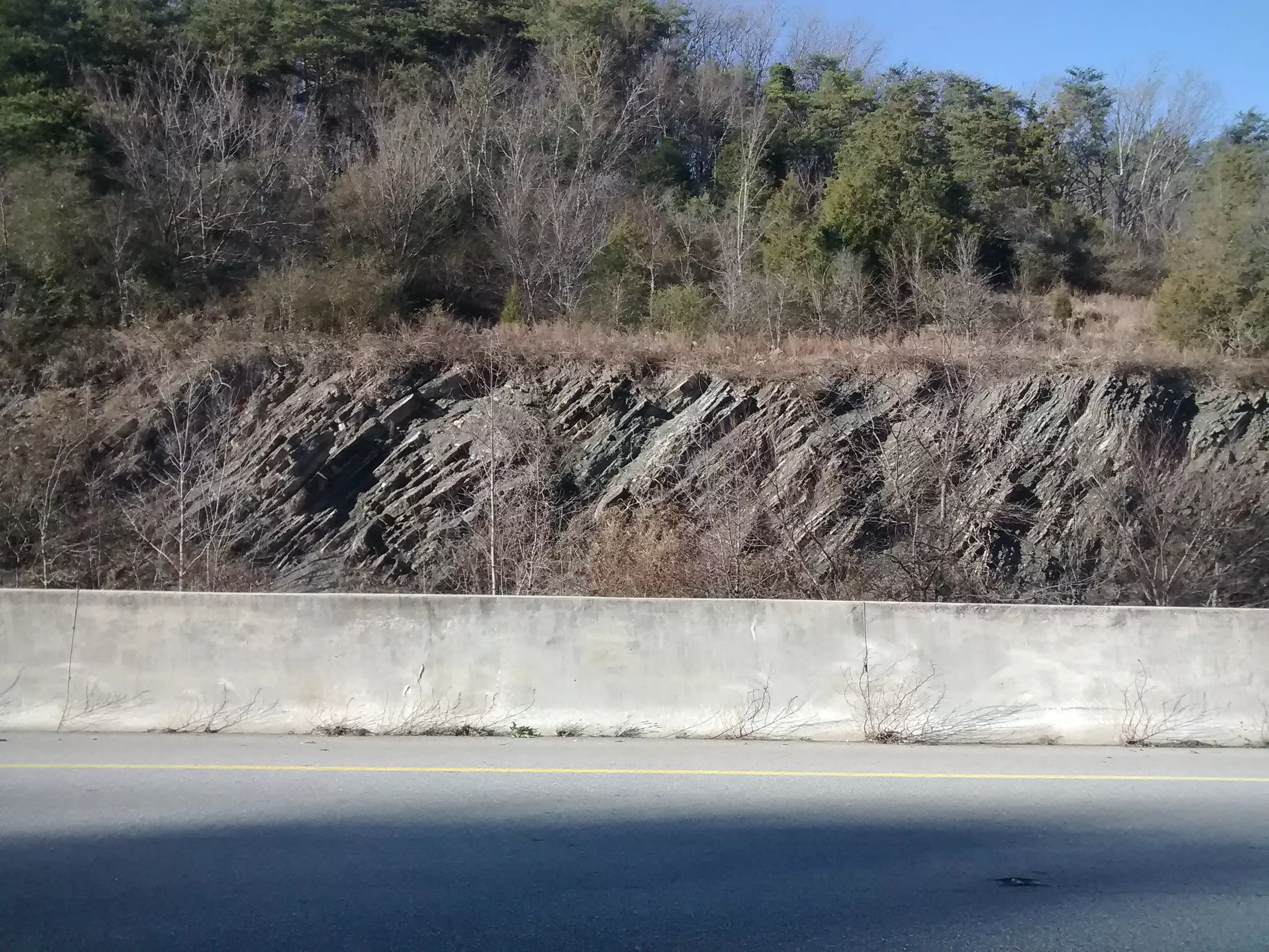
This road cut is in White Oak Mountain in Collegedale, Tennessee. The layers are closer to horizontal (but still tilted by pressures from the Appalachians). You can see the numerous distinct layers with sharply defined boundaries.
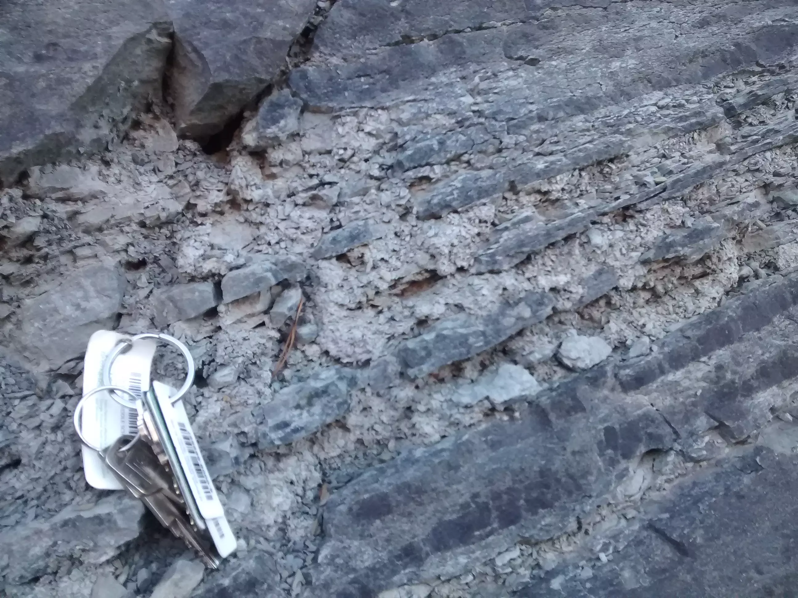
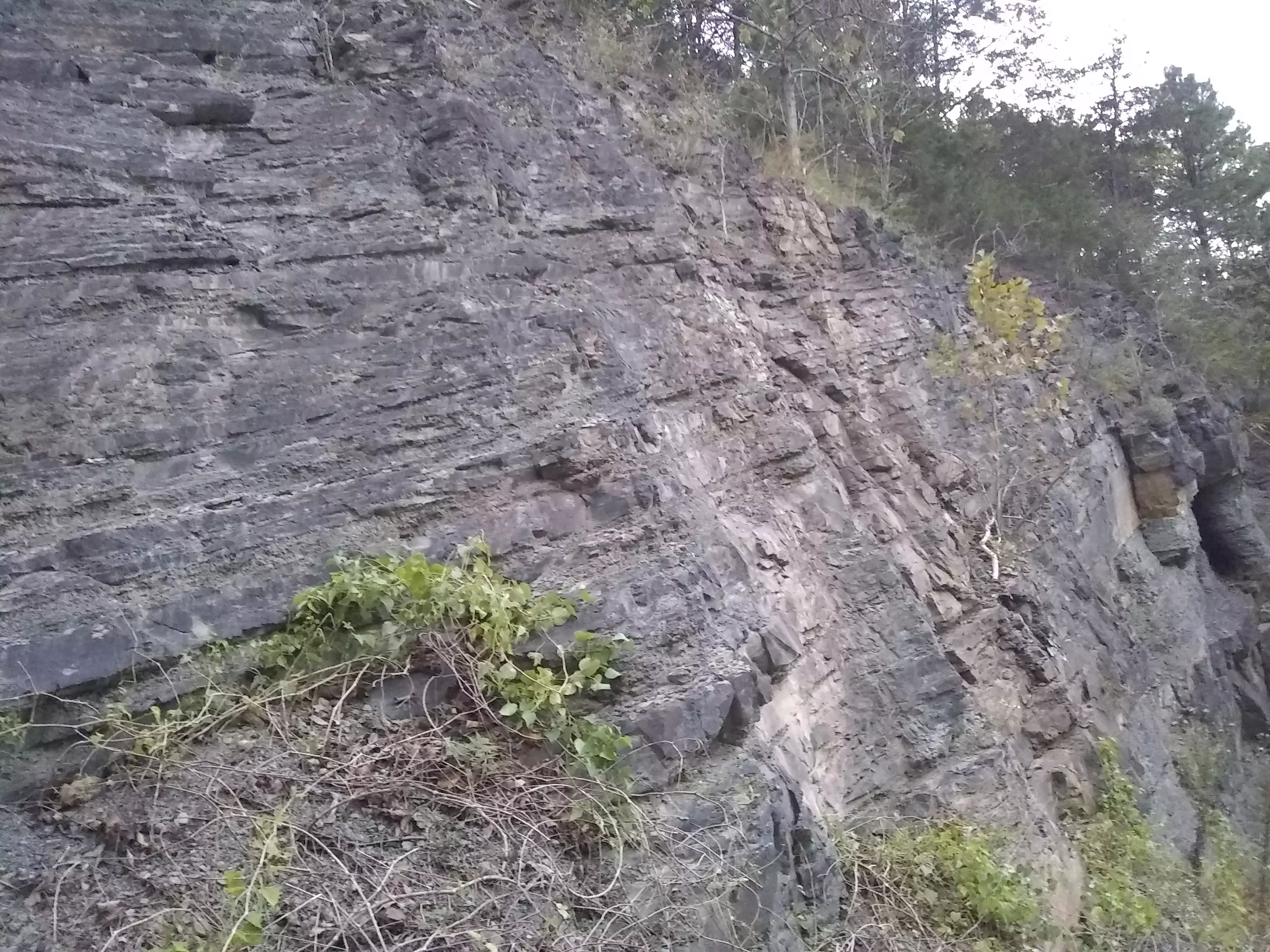
Here is a close up of some of the smaller layers in the road cut pictured above. My keys for scale.
Why Clearly Defined Layers Matter
Layers like these are found across much of earth’s surface. When formed these layers were soft. The layering should have been destroyed long before they hardened into rock. The fact they were not destroyed is very significant.
When we look at nature today we see trees, bushes, grasses, earth worms, moles, etc, constantly disrupting soils and mixing things up. In the seafloor the same thing is happening as small creatures burrow into the ocean floor at all depths 5, 6, 7.
If the tiny ripples I’m pointing to in the photo above had been exposed to plant or animal activity for any length of time these ripples would have been destroyed many times over. The same is true for the layers in the “car key” picture above that. The boundaries of the larger layers should also be mixed with the layers below. But we don’t see mixing. Instead, everywhere we look we see distinct layering.
Why were these layers left undisturbed between formation and being hardened into rock?
It is quite probable the layers were either
- deposited quickly—not giving time for plants/animals to disrupt them—or
- no plant/animal life was present to disturb the layers—such as we see today in super salty environments like the Dead Sea 7.
I personally believe the best explanation is a combination of both—a world wide flood that deposited layers quickly while simultaneously killing the majority of the creatures who would have disturbed subsequent layering, except for the occasional tracks of survivors.
Next time you drive through a road cut and see distinct layering think about a God who left us evidence. Evidence that His Word is true.
References
1. https://www.smithsonianmag.com/science-nature/dinosaur-shocker-115306469/
2. Meyer, Stephen. Signature in the Cell: DNA and the Evidence for Intelligent Design, 2009.
3. Behe, Michael J. The Edge of Evolution: The Search for the Limits of Darwminism, 2007.
4. https://isgenesishistory.com/what-actually-happened-at-mount-st-helens/
5. Chadwick, Art. Lecture, 2018.
6. Wise, Kurt. 90 Minutes of Evidence for the Global Flood (38:30), IGH Conference, 2017.
7. Snyder, Keith. Personal Correspondence, 2018.
8. Austin, Steve. Greatest Earthquakes of the Bible, Acts & Facts, 2010
9. Wise, Kurt. Chapel Spring, 2014, (At approx 29:30), 2015
10. Snelling, Andrew, Transcontinental Rock Layers, Flood Evidence #3, 2008.
Photos
Jeff Staddon is fine with these photos being in the public domain.