[Originally published as Perth geological section, breakup of Gondwana, and the draining of Noah’s Flood]
The Bible tells us that the whole world was covered by water at the time of Noah’s Flood. It took five months for the waters to rise and cover “all the high hills under the whole heaven” (Genesis 7:19), and a further seven months for the water to recede until the land was dry (Genesis 8:3, 13–14).
For the waters to have covered the whole earth means that the continents must have been lower relative to the ocean basins. Then, for the water to recede as the Bible describes means the continents must have risen relative to the ocean basins. This would have started to occur toward the middle of the flood, and the rising of the continents would have caused the waters to recede.

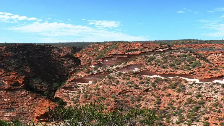
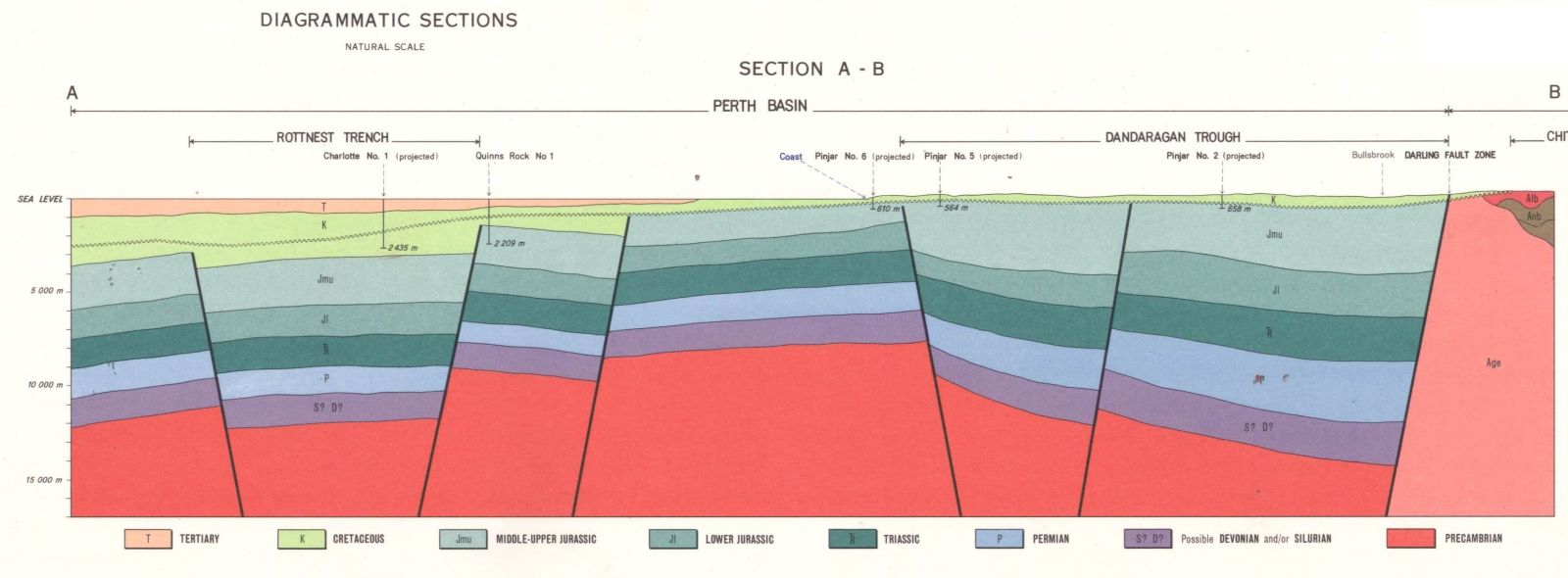
We find abundant geological evidence that this is indeed what happened. Geologists have described the event and given it a name. The above geological section (25 km across, 17 km deep) is through part of the Perth Basin, Western Australia, and provides a good illustration.
Details of the geological section
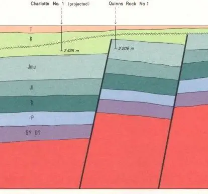
The figure above shows part of an interpreted geological cross-section near Perth, Western Australia. The whole section can be accessed here. It’s taken from the 1:250,000 scale geological map SH-50-14 published in 1978 by the Geological Survey of Western Australia.
The width of the section above is approximately 25 km and the depth is 17 km (remember it’s an interpreted section). The vertical and horizontal scales are the same. The section is to the west of Perth in the ocean. It runs to the north-north-east. As we look at the section we are looking to the north.
The section is dominated by thick sediments (mauve, blue, green, etc) that are almost horizontal but have been broken and moved vertically by the near-vertical faults. The faults extend into the ‘basement’ (red).
The lowest horizontal layer has been labelled S? D? meaning it could be Silurian or Devonian. The next layers as we move up are labelled P, TR, Jl, Jmu, K, and T, meaning Permian, Triassic, Lower Jurassic and Middle to Upper Jurassic, Cretaceous and Tertiary. The sediments sit on a basement (red) labelled as Precambrian. (The labels are visible in the larger image on the previous blog entry here.)
Notice that these horizontal sediments stop abruptly at the faults, indicating the faults occurred after the sediments were deposited.
In the section, you can see that the layers of rock have been broken by near-vertical faults. You can see that the strata to the right (to the east, toward the land) sit much higher than those to the left (to the west, toward the ocean). From the scale on the map we can see that the strata have moved vertically some 3 km. This indicates that the continent has risen and that the ocean has lowered.

The strata on the section have been labelled according to their geological classification (Jurassic, Cretaceous, etc.), and this allows us to connect the timing of the events recorded in the Bible with the geological strata.
Notice that the faults extend into the pale-green strata labelled K (for Cretaceous). The faults intersect the Lower Cretaceous strata, but the Upper Cretaceous strata run continuously across the faults. The Tertiary sediments also run continuously across the faults. It therefore seems that the ocean basins lowered after the Lower Cretaceous and before the Upper Cretaceous. It would appear that Lower Cretaceous was deposited as the floodwaters were rising. However, the Upper Cretaceous strata were deposited while the floodwaters were receding. In other words, the Mid Cretaceous in this section is somewhere near the peak of the Flood.
This is the same conclusion we reached when we did an analysis of the sediments of the Great Artesian Basin, Australia. (Of course we recognize that rocks have been labelled according to the fossils they contain. As we think of the processes that occurred during the flood it is clear that that rocks labelled as Upper Cretaceous in Western Australia are not likely to have been deposited at exactly the same time as rocks labelled Upper Cretaceous in central Queensland.)
Mainstream geologists have connected this faulting with a significant event in earth history, as follows:
The northern part of the [Perth] basin contains mainly clastic rocks of mid-Carboniferous—Early Cretaceous age (Fig. 2), deposited in a rift system that culminated with the breakup of Gondwana in the Early Cretaceous.1
Thus it would appear that the breakup of Gondwana, of which mainstream geologists speak, represents the sinking of the ocean basins and the rising of the continents. This signalled the retreat of the floodwaters as described in Genesis chapter 8, and makes it clear that the flood–post-flood boundary would not have been reached until all the waters on the continents had drained over the subsequent seven-month period. Thus the boundary in the Perth Basin would be well after the Late Cretaceous.
Reference
- Mory, A.J., Haig, D.W., McLoughlin, S. and Hocking, R.M., Geology of the northern Perth Basin, Western Australia—a field guide, Western Australia Geological Survey, Record 2005/9, p. 5, 2005.

